DEM is used as the acronym for the digital elevation model, on the other hand, DTM is the acronym used for the digital terrain model. In the scientific field, both DTM and DEM lack universal use. Some of the definitions have equalized the terms, while in reality, they have some differences no matter how slight the differences might seem.
DEM is a critical component of DTM being a subset of the latter. Both of them, among many others, are used for elevation in the geographic information systems by different users. Often, digital elevation models are used in geographic information systems, especially for relief maps which are produced digitally. Since they use different methodologies, the data/ information delivered contains elevation values that differ. At times it’s challenging to decide on the best elevation model to use. Thus there’s a need to put into consideration different factors between DEMs and DTMs.
1. DEFINITION
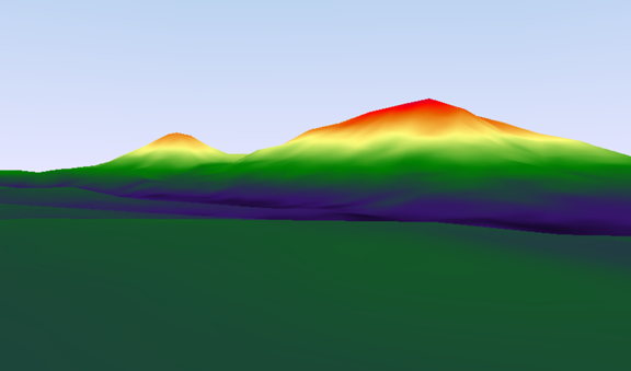
DEM: Digital elevation models are used primarily in the representation of earth terrain, which is bare. It leaves out both men-made features (built) like towers, buildings, and power lines and natural ones, including trees and vegetation. Here, points are arranged in a grid format (raster data) with every cell representing an elevation.
DTM: Digital Terrain model is defined in two different ways depending on your geographical location. In some, its meaning is the same as that of DEM representing bare earth, while in others, it has a small difference. Unlike DEM, this has some points regularly spaced and natural features (e.g., Ridgelines, coastlines, faults, passes, and drainage lines). This factor of ability to retain natural features makes it preferable for applications in engineering fields.
DEM lacks information concerning terrain surface as compared to DTM, which provides all this.
2. CREATION
DEMs are mainly created by the use of data that is collected by the use of remote sensing techniques like geodetic surveys and aerial photography. A land survey is also provided as a source/ tool in creating the models. A LiDAR dataset is used in generating a DEM. The use of this can assist in uncovering geological features and archeological ones that might have been hidden or masked from photogrammetric analysis as a result of terrain features occurring naturally.
DTMs are created from stereophotogrammetry. DTMs acquired from ALS (airborne laser scanning), which have the ability to penetrate through dense vegetation with a high resolution, provide data for mountainous regions. It’s not hard to derive DTMs from densely forested/ vegetated areas.
3. PRODUCTS
DEMs contain a variety of products, which include hill shading, slope aspect, angle, length, and convexity. The 3D display is also a DEM product.
4. USAGE/ FUNCTIONALITY
DEM. The digital evaluation model is useful in planning for land usage (especially sparsely vegetated sloppy areas) soil mapping and, in some cases, hydrology (delineating watersheds, calculating the flow accumulation and direction).
DTM. The digital training model is used in geological applications, drainage, flood modeling, as well as planetary science. Just like DEM, it’s used for land-use planning.
5. APPLICATION DOMAINS
DTM is applied in various fields which include; civil engineering which entails site planning, road design, and in construction of water reservoirs and dams;
Earth sciences entailing hydrology modeling, geological mapping, delineation of water bases, and preparing slope maps;
Resource management which contains the location of sites, natural resources management to ensure sustainability, and geometric correction of images collected by the use of remote sensing techniques;
Military applications. Both consumers and producers benefit from this. It allows for a clear analysis of how to manage the battlefield and guidance on the weapons to be employed. From this aspect the end goal and objective remain specialized with high demand;
Surveying as well as photogrammetry serve as key sources during DTM generation. In this case, DTMs enable quality data assessment required by particular users.
On the other hand, DEMs are commonly used for the study of route alignment, land usage analysis, soil science, management of infrastructural projects, and geomorphological interpretation.
DEMs are used in different types of applications, which range from phone apps to applications of satellite navigation. Google earth applications also use DEMs as well as radio planning and civil engineering.
6. DATA INPUT
For the DEMs, data collected directly from digital matrices are easily accepted, and in cases where irregular data was mistakenly used, there must be resampling of it. However, there is an obvious shortcoming of this model whereby it causes redundancy of large data when describing flat ground, yet it cannot clearly provide details concerning complicated ground.
DTMs do not require resampling of data, and unlike the DEMs, they tend to accept randomly collected and sampled data from different sources.
7. FEATURES INCLUDED
Since DEMs are mainly focused on bare earth representations, they leave out/ miss to capture topographic features. However, it can include some data that can be deemed redundant, especially in low relief terrains.
DTMs will capture every detail, including linear features like brake lines (ridges). Point features like peaks and spot heights are accepted. In areas where the terrain is complex, its density may vary in the sample points.
8. COMPLEXITY
Digital evaluation models are usually less complex, thus easy for the practitioners to use them, and they are CPU intensive. It’s easy to compress the DEM regular grid since there is limited storage. Also, the format is preferred for computer management, which makes it the commonly used form for the usage and supplying of data.
DTMs are more complex and require expertise in some areas to ensure the task done is effective. The storage, organization, and application of DTM data are more complicated as compared to that of the DEM regular grid.
9. COST
DEMs are cheap to produce, and they require less time.
Digital terrain models are quite expensive, and also production takes a lot of time.
10. TASKS
DTM filtering has three key tasks, including DTM delousing, generalization, and decomposition, which is the separation of topographic surface components of high-low frequency.
A DTM is more advantageous compared to DEM as it provides more than just the elevation captured from the first feature and also the ground altitude. This makes it well suited for usage in mining operations and drainage systems.