Geographic Information System is a system that has been put in place specifically to capture, store, deploy, evaluate and present geographic data. This system has proved effective in the agricultural sector in various ways. The tools that are represented by the system have enabled users to create questionnaires, which are interactive in nature, analyze three-dimensional information, edit data in maps and present the findings of the operations. GIS comes as an advantage to farmers because it helps them in achieving the best in terms of production and reducing extra costs, which could have been incurred in operations, resulting in better management.
1. Agricultural mapping
The application of GIS in agriculture is important because is very helpful in mapping the current and future variations in the sleet, crop output and temperature of the soils. The mapping of the current features of a farm enables scientists and farmers to work together towards the same goal of creating more diverse, effective and efficient farming techniques. In addition to that, this helps in increasing food production in a country and can eliminate the problems of food shortages in specific countries.
2. Soil analysis
Geographic Information Systems is also important in agricultural soil analysis because it helps in determining the type of soil, what plants to grow in it and how to maintain the nutrients present in the soil to the benefits of the plants.
3. Data combination
GIS, together with many variations in the USDA sectors, have been used in the combination of large amounts of data into a data set. For instance, countries such as the United States use GIS systems to solve any crop issues that arise, protect the crops and provide solutions to fake claims of crop damage. Furthermore, the system has also given the farmers an added advantage of having access to their crop information every season.
4. Interaction with farmers
Geographic Information Systems have helped farmers, especially those in the United States to access the data on their lands. This does not necessarily require them to have the GIS themselves. In addition to that, this also helps them in interacting with the data, ask questions and provides reliable and valuable on-ground data that cannot be generated through the use of satellite. This, in turn, increases the accuracy of the data provided by the machine in the end by about ninety percent.
5. Nutrient determination
Nutrients in a field need to be determined first before farmers come to a decision on adding nutrients to the soil. Geographic Information System is used to study the different statuses of nutrients in a field to enable farmers to reach a specific requirement for the external application of nutrients. This helps in the combination of computer software modeling analysis with site analysis for a conclusive interpretation of varying outputs and inputs.
6. Assemble information
Geographic Information System is used in assembling different layers of information such as soil moisture, nutrients, elevation, and topography, to aid in the production of a map, which will show some of the factors that influence crop yield. Furthermore, the yield is used as a future reference and the economic inputs and outputs are premeditated based on the expected yield.
7. Store geospatial data and produce maps for land inventory
The data that was provided by the Geographic Information System indicated whether the land in question is capable to support agriculture, wildlife, tourism and forestry among others. Land that is capable of supporting agriculture is essential because it helps in the production of crops both locally and globally.
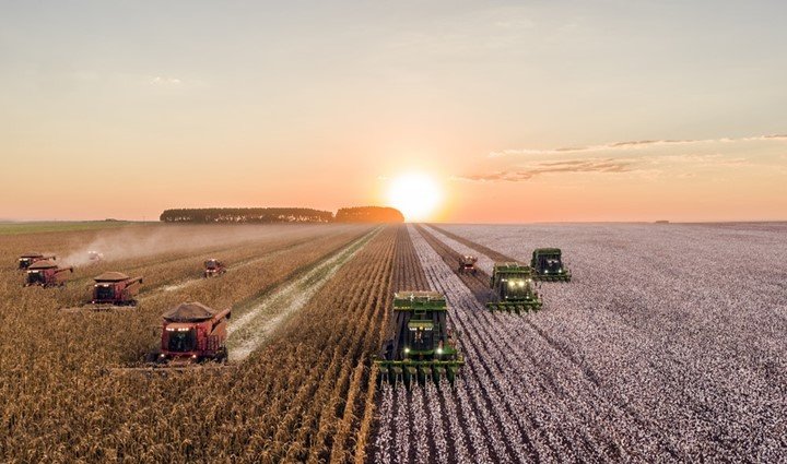
8. Precision farming
The sensors present in tractors, satellites and in fields play a vital role in collecting data. Using Geographic Information System in this area helps in the shaping of the collected data into viable information that is accessible and easy to interpret by land managers and farmers. In addition to that, this helps in the making of informed decisions.
9. Real-time mapping
In the past few decades, the use of satellites and drones has become popular and has drastically grown. Moreover, framing has faced many challenges with the main challenge being the management of water used for agricultural purposes and its availability. Using satellite technology helps in the collection of real-time data from the surface of the earth, accesses, and monitors the condition of the land. In addition to that, the use of drone technology has aided in the collection of data, especially local field data such as the height of plants, diseases, flower count and the presence of weed among others. This improvement in technology has helped reduce the amount of time that could have been consumed in walking to and from the field in search of data.
10. Raising alertness
Farming is one of the agricultural sectors that need awareness, especially about crops and their availability. Geographic Information System comes handy in this sector because of its effectiveness in increasing food scarcity awareness. Once the affected area has been located, the necessary assistance is provided. The underlying causes of food insecurity are determined and the GIS data is used in safeguarding the various communities or areas that have been affected. Geographic Information System has allowed farmers to envisage study and understand the extent of the geographic data that is being stored every day. This data is easily communicated to various farmers, which in turn helps them to know the crops that are thriving, the controlled use of fertilizers and the extent that natural disasters and pollution hinder production.
11. Historical data comparison
The availability of food in the world has drastically reduced because of the increasing number in the population. This is a great concern, especially in today’s governing agencies because securing the necessary food sources to support the continuously growing population has been difficult. Research has shown that in order to meet the future needs for food, the current production of crops needs to be doubled by the year 2050. Geographic Information System is used in real-time analysis and in the comparison of historical data.
12. Analyze and visualize agricultural environments
A farm can only be successful and profitable when there is a balance between its inputs and outputs. Geographic Information System has proved to be handy in this sector because it analyzes and visualizes the agricultural environment and the flow of work in these environments. This has proved to be beneficial to those involved in the farming industry.
13. Increase production
Furthermore, GIS is applied in agriculture to enable farmers to increase their production. In addition to that, farmers are also able to reduce costs and manage their land more effectively and efficiently. This is done through the scientific analysis of production data, which is stored at the farm manager’s office.


This program is very good and interested