Delivering accurate data is one of the challenges that surveyors go through. There are a number of technologies and specific software that surveyors depend on in gathering the information available, collecting new information, analyze and manage projects, and deliver accurate data. Geographic Information System comes handy in this area because it brings all the information into one place and help in the provision of a central location used to conduct data analysis, and come up with effective solutions and systems. Storing data in individual files can be very inconveniencing because these individuals may decide to protect the information they have using passwords. On the contrary, GIS does not store data in individual files, rather it is built on a database, which enables surveyors’ access the information, reuse, analyze and share the information that they have.
1. Planning
All surveying activities require adequate planning. Geographic Information System is incorporated in surveying to assist in the planning aspect of the whole project. In addition to that, necessary tools such as research tools, the development, implementation, and monitoring of how a project is going on are used with the help of GIS. It also manages the site location and the impact of mitigation on the environment among other important aspects. Planning a survey project is not the same for all the projects available because there are a number of unique requirements such as the purpose, area and the objectives that the project has put in place. Using GIS technology helps in accomplishing these tasks faster and working on all the other activities, which were earlier on deemed as impossible.
2. Developing roads and other infrastructures
Any development that needs to be done on any infrastructure requires an individual to have an idea about how surveying is done. This happens in different scenarios such as establishing transport systems, building roads and developing communication systems. The information system that is centrally based on Geographic Information Systems software helps in the provision of a framework for maintaining data and its applications across different sectors.
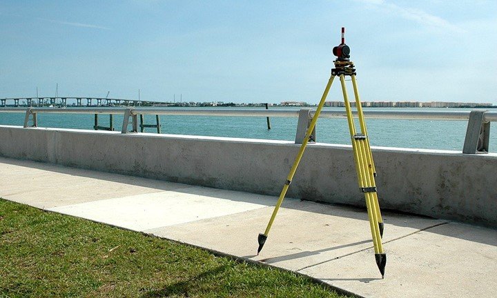
3. Collection of Data
Data can be generated both remotely and in the field with a GPS. Adopting the use of GIS software adds intelligence to the three-dimensional data collected. Surveyors are responsible for entering raw data into the systems, field sketches and measurements directly into the Geographic Information System. Consequently, this enables surveyors in effectively managing their data from a central place. This, in turn, improves the productivity of both the surveyors and the whole work environment. Moreover, GIS is used in the collection, conversion, and storage of three- dimensional measurements. These measurements can be applied to any agency and private business of any size.
4. Construction
Coming up with a construction project is easy, but starting and finishing the construction plan is difficult because it involves complex plans. For instance, specifications, environmental permits, and layouts are some of the factors, which need to be considered before proceeding with any construction project. A successful project requires many aspects to be put into consideration such as takeoffs, the safety of the site, conflict, and logistics among others. The advanced GIS technology helps in improving the mechanism for building new infrastructure. Engineers, surveyors and any other person rely on GIS technology for open communication.
5. Analyzing a design
A site must be investigated before any project is erected in the area. The conditions, which are on the surface, influence the survey methods, which will be used, and this, in turn, affects the total cost of the project and it’s scheduling. Engineers rely on Geodatabase known as ArcGIS and surveyors in the storage, inputting and in the questioning of the soil described and relate the information to the predesigned engineering information. In addition to that, civil engineers also benefit from using GIS, which helps them in keeping track of the urban indicators and predicting the future needs of the community. This guarantees the provision of an affordable and quality life of the community, providing them with communities that they can live safely.
6. Land Development
Developing a land requires so many factors to be put into consideration. Some of these factors are the drainage system, building sites, boundaries to other properties and roadways among others. With the help of the Geographic Information System technology, surveyors have the tool to capture and create new data, through advanced mobile experiences. The manual collection and storage of data is unreliable because there is no backup for these data in case they get lost. GIS offers a solution to this problem storing data in a central location. This is an advantage to the surveyors because they can easily access the information and make changes where necessary.
7. Facility Management
An information system that is based on GIS technology enables surveyors to improve on productivity and communication. Also, Geographic Information System is used in the collection of divisions in various organizational departments and this helps in the streamlining of workflow, management of assets, planning, and operations of the organization. The sharing ease of access to geographic data is enabled with the use of the GIS technology. This specific information system promotes the integrity of data, increases better communication, and improves good decision making in the entire organization.
8. Survey data management
The most critical aspect of any survey is determining whether the information, which has been provided by the surveyor, is credible. The smooth flow of information among planners, engineers, surveyors, and designers is facilitated with the help of the ArcGIS. Some surveyors use GIS in managing and storing individual projects, which in turn aids in the building of a survey information system with time. Most of the time, data is stored in individual files which are never looked at because of the bulkiness, but GIS helps in storing all data which has been collected during a survey in one database. This provides ease of access to past data, which can be reused or compared with the new data for the purpose of making informed decisions.


good