What is GIS?
Geographical Information System, or GIS for short, is used in forming a geographical understanding of a landscape or expansive region. GIS is used to make this topographical information more accessible and easily understood. The geographical knowledge obtained from GIS is often used by large businesses and corporations to make important decisions such as locating where to start a factory to save costs, whether or not an environment is suitable to industrial needs or finding marketing and customer-related solutions. For this reason, GIS can be considered as a scientific tool that makes use of both hardware and software to serve as an information management platform.
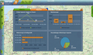
How GIS makes use of hardware and software for spatial and geographic analysis.
GIS hardware comprises such as printers, monitors, motherboards, connectors, and other staple parts of any computer system that are key to allow data processing to take place. However, GIS also makes use of software that comes with tools to run visual queries, manage frequent data edits and compute meaningful information that can help decision-makers to take place. GIS is extremely efficient when it comes to being able to use both hardware and software components to elaborate on specific components of data and simplify others. This allows GIS to become a useful asset that can be used in statistical analysis, becoming economic development opportunity decisions, understanding the physical characteristics of a location, and understand landscape details such as soil, vegetation and so on.
What is Digital Image processing relevant to GIS?
Digital Image Processing in the context of GIS is the use of complex algorithms to manipulate data and process images. This process is used for real-world technology solutions such as organization, feature extraction, being able to project, recognizing patterns and signal analysis that is conducted on a large scale. It can perform these processes to simplify data, break it down and reassemble it as required. It has also been used to compute satellite technology images. Digital Image Processing is able to output stellar and sophisticated results because it takes input data and processes it while avoiding problems such as the build-up of noise.
What are the differences between GIS and digital image processing?
Digital Image Processing is a function, whereas GIS is a complete system on its own. Once relevant data is received, captured and stored by a GIS, digital image processing is a function that can be applied to the data to better understand it. GIS records a lot of data that is too complicated to be understood easily, which is why digital image processing is used to simplify data using complex algorithms to create models and visual representations of data.
In conclusion, the main difference between GIS and image processing is that one is used to process data, and the other is used to process images/visuals. GIS is entire hardware and software-based system, whereas image processing is a function that is used to make GIS data more useful.