All disasters are spatial in nature. Most of the time, they are unplanned occurrences that happen as accidents. Furthermore, disasters are unavoidable in nature and affect all aspects of the human sectors from the social, economic and environmental sectors. Disaster management is the organization and management of the available resources for dealing with all aspects of emergencies to lessen the impact of the damage caused. GIS in disaster management acts as a tool for supporting decisions. The application of GIS in disaster management helps in understanding the nature of the disaster and this helps in solving complex management problems. In addition to that, decisions can only be made by analyzing the different Geographic Information System layers. Management and planning of disasters, as well as handling disastrous conditions are currently useful, with the help of geo-spatial and socio-economic data.
1. Preparedness of disaster
The awareness and preparedness of disaster is one crucial area. Some of the crucial questions that arise from this area include; what is the total number of people in the affected area? What is the location of the buildings and infrastructure around that area? The number of people at risk and the evacuation time and technique? What are some of the structures that can be used as shelters? These questions come up anytime a disaster strikes a particular area and location. The database of critical facilities such as hospitals, police stations, ambulances, fire stations, and schools can be built up by GIS and remote sensing techniques. This is helpful for planning purposes.
2. Planning and Mitigation
In the early years, whenever disaster occurred, the role of the government was limited to rescue, relief and rehabilitation. Time has passed and mitigation and mainstreaming of disaster risk reduction are one of the crucial activities, which require the intervention of the government. With the application of Geographic Information Systems, the development of decision support cables for assessing risk from natural disasters is achieved. The effectiveness and the cost of the response and the recovery of the disaster are in relation to the extent of the planning and how appropriate the process is. This helps the government in the mitigation and planning of disasters.
3. Response and Recovery
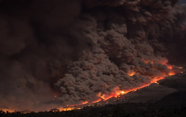
Responding to a disaster in a given area requires detailed information such as where the disaster has occurred, the intensity of the damage caused, where the affected population is located and the resources needed to evacuate the affected individuals. Having knowledge about the above information requires one to understand the geography of the affected area. This helps in modeling the hazard intensity and the level of severity. An understanding of the impact of the disaster on buildings is achieved and at the same time, a response to the disaster for the evacuation and rehabilitation is applied. The usage of drones, together with Geographic Information Systems and satellite imagery, help in finding the answers to most of these questions and conducts all of the above tasks in a planned, effective and efficient manner. The use of mobile GIS in field recovery provides the capability to integrate and also provides a display of the damaged areas in different locations.
4. Building a common operating environment
Solving the damage caused effectively requires the response and recovery team to have all the information required at hand. Geographic Information Systems help in collecting information from sources that are different and combines the information acquired to create intelligence which is used to effectively manage response and recovery.
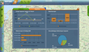
5. Data Management
Consequently, gathering and storing information is essential in disaster management. This is because it helps in attaining a certain level of preparedness. The integration of information from multiple sources is important and possible with GIS. The information, which has been provided in the Geographic Information Systems catalog, needs to be as accurate as possible. The catalog is used in providing useful and relevant information whenever an emergency occurs.
6. Providing live data
In the past, solving a disaster required the use of intuition and most of the decisions, which were taken during disasters, were taken based on prior information, and not the live information, which has been provided. This is different from recent times because live data is provided on many factors such as infrastructures, the geography of the location, the population of the affected individuals and the topography. This is important in the response and recovery step. The application of Geographic Information Systems is important because it helps in integrating data obtained from various sources, and makes the information gathered accurate and readily available for stakeholders in disaster management.
In addition to that, the applications of GIS helps in providing the information required in a timely manner in cases of emergencies. The data that is provided has the capability of rapid exchange that is easy to understand and act on. The relevant authorities then visualize and analyze this information for the purposes of making an informed decision. Consequently, the decisions that the management could have arrived at help in providing timely and accurate information such as where they should take shelter and evacuation routes among others.
7. Flood Mapping
This is one of the most frequent and costly natural disasters all over the world. Floods occur because of economic loss and the hardship that human beings have to go through. Lately, the flood management team has increased its interest in obtaining a reliable flood map. The preparation of these flood maps is the latest concern of any flood management team. Various approaches have been already taken for possible flood mapping. The most important indicator of the management of floods is the depth of the flood. Consequently, identifying the flood depth helps in formulating Geographic Information Systems, which will, in turn, be essential in determining the depth and the level of harm that flood has caused. In addition to that, using GIS in this scenario helps in saving more life because human presence will not be needed in the disastrous area. GIS provides real-time data which is essential in response, recovery and decision making.