Geographic Information System though spatial analysis comes out with individual segments of information that is widely used in different areas. Data for sectors such as transport, forestry, land planning, and agriculture and architecture can be derived using GIS Software. This data is used in different government offices for planning and even in industries. Below are 50 uses of the GIS data.
1. Mapping
GIS generates maps that are loaded with data and information that is widely used all over the world. The maps show roads, constructions, industries, and even natural features. Today it is possible to make decisions based on the map information. For example, you use it to know where to navigate to.
2. Pest control and management.
Areas that are highly infested with the pests are mapped using the GIS. Therefore this data can be applied in the agricultural ministries to spray or come up with solutions for pest management.
3. Management of irrigation
Areas and their climatic conditions can be widely explored online. During the planning process, both at the individual level and the government level, this information can be used to show areas that need to be watered. Rivers and sources of water are identified, and then this helps understand the possible method of irrigation.
4. Planning and resource allocation
Resources and amenities are widely distributed and shown on the GIS maps and the GIS data files. These maps show how the facilities are scattered or their availability in the sea. During the planning, then industries concerned help allocate some projects.
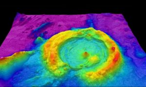
5. Geology
Analysis of rocks and the types of stones helps identify the vital resource. The study of stones uses the maps to get all the details concerning rock distribution.
6. Surveying
Preparation of digital maps showing the land ownership and allocation is done using the GIS information. Boundaries between counties, cities, and regions are all depicted on charts.
7. Navigation
Transport sections and routes can be obtained from the data in the online GIS software. An example is the google map data, which is highly used for the movement of people from one area to the other following the routes on it.
8. Disaster management and mitigation
Disaster management organizations can use the data formed using the GIS software to come up with possible areas where disasters such the flooding can be frequent. The contours in maps help get the land terrain, which can be used to know the lower areas that are profoundly affected by the floods and various steps taken.
9. Agricultural sector
Farmers and plantation owners get information concerning the types of fertilizers from the gGIS software, either directly or indirectly. The GIS data contains soil structure, mineral components, and soil patterns.
10. Urban planning
Planning streets and building areas in an urban center take GIS, and the allocation of the land for construction needs to use the map data. The study of the location also helps to set the standards of the buildings to be made in the area.
11. Telecommunication network
How the telecommunication companies distribute the loose waves and data within a specific location is used to make decisions regarding areas that need expansion. Therefore more networking processes go on after the finding on the map. The relation is obtained using the map and the company data.
12. Calculate distances.
Through the proximity analysis, the data showing the distance relationship between two points is determined. Navigators use this data, project developers to get the distance they will have to cover.
13. Road safety analysis.
Using the GIS data, the tallies of road accidents are summed, and safety measures are taken. The analysis of the blind spots along a road can be done using the GIS software.
14. Urban growth monitoring
GIS software and apps can enable both aerial view and 3D view of the cities, growing metropolitan areas, and towns. The expansion of the city is monitored every day.
15. Environmental impact analysis
The impact on the environment, including the air, water, and soil, can be analyzed using the GIS software. The study done from location to location gives an oversight of the exact situation and control measures taken.
16. Asset management
GIS is an essential software when it comes to the analysis of the existing assets of the industries. It can help you locate industries, and their location is identified. When companies want to know the extent they have covered, they use GIS software to see how far their growth has gone.
17. Space usage and planning
Managers of specific countries and lands can be advised on how to use the area with analysis from the GIS software. The types of resources to develop the buildings, and with 3D visualization, virtual reality is shown. You can get the services at a low price.
18. Coastal management
The coastal zone made of mangrove, coral reefs, and dunes needs to be well divided for specific purposes. Some of the uses include the beaches, harbors, and dock areas. Therefore this allocation requires the use of location, which can be aided by the use of GIS.
19. Cable
Most undergrounds ferry water through pipelines, gases, and fuels. These need to be monitored, and an excellent record kept regarding where the companies have set up the pipes. The vital part of it is that it helps in leak detection hence control
20. Wildlife management.
Where wildlife should be kept and the authorities specify the parks for marine life. To assign these areas, specific analysis is made, and then using the map, the boundaries between settlements and the parks are set.
21. Mapping archaeological sites
Areas, where traces of past information can be obtained, are mapped using the GIS. Therefore it becomes easy for archaeologists to understand what they will go for in a particular site.
22. Development planning
When planning, especially an estate or an urban area, GIS software becomes the central player. GIS enables the plan to be more organized because the data produced shows where to locate the buildings, the height of the building, the number of people to benefit, and the impression it will create is seen through 3 D simulations.
23. Aspect analysis.
The aspect is used to understand the ice melting. A GIS helps identify such sides and map them on the records. This is especially important in the arctic and antarctic continents.
24. Mapping of natural features.
Mountains, lakes, rivers, forest areas and hills are mapped using the GIS. Their location would have been tight if it were not for the information provided by the GIS.
25. Flightpath allocation
No doubt maps have shown ways on the air as if that was ground. These airways and air navigation routes are studied using both LiDAR and the GIS software then analyzed to get the specific course to be used. The mapping is done using the GIS software too.
26. Banking
Banks and other financial institutions apply GIS software to understand their level of spreading within a particular economy and how they are faring when it comes to extending their services. This is done by looking at the mapped data showing their branches, ATM areas, and using all this data, more decisions are made.
27. nearest location
When in areas not familiar with, most people tend to apply GIS software to locate the nearest location offering what they need. For instance, some would use the google map to find coffee shops around.
28. Local advertisements
When adverts are intended to be specific and localized, the range of the advert appearance is set, and this must apply geocoding techniques. Therefore GIS, which deals with geocode data, is used to give the information.
29. Online purchases.
Where to make purchases and the reviews of areas that offer specific services are all online. There is data of stores that are within reach, and information regarding how to contact them is posted online together with the location. To make a combination of the two, the GIS software data is applied.
30. Forensic GIS.
Think of a crime committed, and the car is missing. The GIS software, with some other software, is combined to aid the search. If the vehicle has a track recording mechanism, then the directions and the information regarding the vehicle can be traced. This uses GIS data.
31. Earthquake detection
Using the GIS, it is possible to determine the earthquake epicenter and this aids in understanding areas that can be affected by the earthquake. Therefore GIS data helps calculate and even name the specific regions that will be affected by an earthquake.
32. Event updates
Several groups of events and meetings can be uploaded on different platforms. The venue of the game and the directions are all obtained using the GIS data.
33. Facility developments
When allocating the specific areas where the dams and other features need to be developed, GIS is used to map this information. There are different areas where some analysis is done, and the final spot for the project is determined.
34. Pollution levels
Areas with high levels of pollution are spotted on the map and located for the government and concerned agencies to take action. Therefore using GIS, the extent of the pollution effect can also be established.
35. Disease and epidemiology spread pattern
When an outbreak is detected, the analysis of the cases that have existed is mapped so that the health sector can manage and control the patients. For instance, Ebola in Liberia and the coronavirus in china. These are put on a health chart to aid in preventing disease spread.
36. Historical mapping
Things of the past, like the migration routes, settlement, and historical activities, are put on the map to aid the understanding of specific regions. The culture of people in those areas is also mapped, and this helps newcomers understand.
37. Mapping of human activities
Areas are mapped according to what happens. From map reading skills and interpretation, you can know what activities people practice in certain regions. These include agriculture, cattle keeping, and industrialization
38. Zip coding
Spaces are assigned zip codes and numbers to identify them using the map. Street names and the location can be understood using the street codes. This cannot even be existing if GIS data never existed.
39. Social media monitoring
What people are doing on Facebook, WhatsApp, Twitter, and Instagram can be monitored based on location. Suspicious activities are detected using the GIS data, and these are put in the light by making follow-ups. These sites use GIS data to detect your location.
40. Trending tweets
The Twitter platform performs a search for the frequently used keywords based on locations and then put these keywords on the trending lists. Each site has a different trend. Therefore this uses GIS technology.
41. Crime scenes
GIS uses the mapping techniques to come up with areas where crimes are rampant and map them in the geographical location map for investigations.
42. Terrorism hideouts.
Before a search on where terrorists take shelter is initiated, various searches are made using the GIS software. The analysis of the whole area is built on GIS platforms to establish possible hideouts before the combing is done.
43. Vegetation mapping
The type of vegetation existing in different areas is mapped using GIS software. This is, in most cases, carried out on maps by shading them with colors whose meaning is explained in the scale. GIS is needed for location and the survey.
44. Antenna heights and telecommunication spots.
For the individuals who contact the network installations using the wireless access modes, there is an excellent use of longitudes and latitudes to measure antenna visibility and wave penetration.
45. Trip planning
When planning a tour, GIS and map information must be used to locate areas to make stops and hotel searches.
46. Fleet management
Companies with several cars and locomotives, take a measure to install them with geo trackers, which make use of maps and map details to locate these locomotives.
47. Programming
In the field of websites and application development, the GIS data is used to help individuals get the map areas. This is so especially for those who plan to embed maps on their websites.
48. Weather conditions
The weather is recorded and presented to individuals using GIS GPS. When the users want to understand the temperatures, the weather forecasting department already gets it mapped to appear in the form of notifications in select phones.
49. Call tracking and caller location
The telecommunication companies have a provision for getting the call tracking information based on the last call. This information uses GIS data to track.
50. Cloud computing
There is an excellent use of GIS maps for faster decision making. Cloud computing is gaining strength, and demand is rising. Maps are highly used in this area.
Yes, GIS is so helpful to our lives because technology is anchored on it.