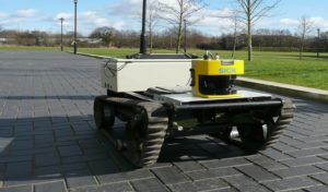
LIDAR means light detection and ranging. This technology applies the use of detection techniques to get the distance or the ranges of spaces. The ranging or measuring of distances involves illuminating light on the object and some calculations follow. The light beam is illuminated on the object where the data needs to be collected from and then a sensor times the time taken for the information to get back to the sensor. Then calculations are done by use of the time taken longitude, latitude, and elevation.
The time taken is multiplied by the speed of the beam of light then divided by two to get the distance that exists between the object and the sensor. These lights can be used in different environments including the water. The information drawn from these sources is very important in the Geographical field research and almost every sector of the economy uses LiDAR.
1. Mapping coastal areas.
LiDAR data can be applied in the designation of the water level in the coastal areas. Using the elevation measure both and low tides are determined and this can be used to designate the coastline. This is a safety measure towards the future changes that might happen and helps minimize the possible impacts.
2. Generate digital elevation models.
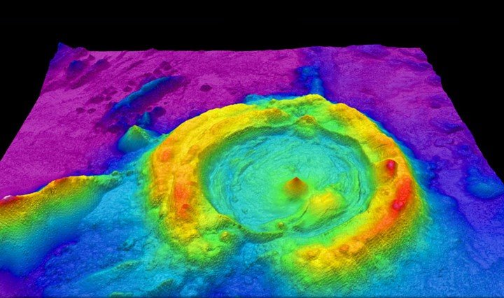
LiDAR generates the model of the ground terrain surface through the mapping. It shows the ground appearance and especially the surface features. These measurements are highly required in the GIS analysis. These would help in the designs of the roads, railway lines, and bridges.
3. Measuring microtopography.
LiDAR technology is very accurate and is highly used by GIS users to complement the GIS in the measurement. The ground topography can be measured and in this case, the GIS can achieve the intended results when this complement is made.
4. Agricultural analysis.
LiDAR is used in the field of agriculture to determine the exposure of the ground to the sunlight and soil properties. The characteristics of the data collected complement the GIS in the explanation of the geographical position. The analysis of these results is used to determine crop viability and the crops that can be the ideal for the specific type of climate.
5. Forestry planning analysis
LiDAR finds a wide range of use in the departments concerned with forestry too. There are different areas that need information and LiDAR answers exactly that. LiDAR can measure forestry canopy structure, and identify the areas where the forestry is highly threatened by humanity. These details are then forwarded to the GIS departments that now help combine the pieces of the information together and raise positive oriented points with evidence and then the solution is sought.
6. Fire behavioral model data
LiDAR can detect the presence of fire incidences in an area. The management measures can be put in place following the knowledge of the fire high-risk areas. Therefore forests and settlement schemes are designated widely by the GIS experts.
7. Gazettement of forestry areas (precision)
Forestry areas need to be designated so as to achieve high wood production and support wildlife. Therefore to achieve this LiDAR is applied in the precision process. While GIS plays the major role of looking for the specific locations of such areas, the LiDAR helps study the 3D terrain.
8. Park management and precision
LiDAR DEM helps get the 3D terrain and helps the GIS analysis by complementing it.LiDAR offers some details that are used in the explanation and understanding of the parks where wildlife and other tourist attraction features are found.
9. Environmental assessment
LiDAR elevation and microtopography data help the users understand the environment and the characteristics of the environmental features. The state of the environment can be analyzed and determined to form the details. Areas that have been affected by human activities can also be made visible. This can be achieved when both the GIS and LiDAR are used.
10. Wildlife study
GIS needs to generate information about the region and some features in the region. With LiDAR the GIS software can be used to understand areas where the wildlife can survive. This is achieved through joint analysis of the latitudes, longitudes and forest distribution.
11. Flood model
LiDAR and GIS give data that is relevant to the flood model analysis. LiDAR studies the elevation and the land terrain. This will help understand different flooding models and the possibility of flooding.
12. Stream delineation
DEM is the main feature that LiDAR gives to GIS users. This data finds uses in the field such as the watershed for the particular water channels and looks for stream channels. GIS software is the creator of this information guide.
13. Ecological and land allocation
LiDAR gives quality data and images for the ground surface. This information is used to analyze the geographical positions and hence used in land segmentation that aims at the allocation.
14. Surveys
Greenlight that is used in water penetration can be used to understand the water environment. The contents in the water bath in rivers and oceans are obtained from the survey. This helps obtain the river model hence complement the GIS in the explanation of the physical features.
15. Pollution model
LiDAR can be used to show the pollutants in the atmosphere through the analysis model that is presented in the wavelength of the light that is emitted.
16. Mapping
GIS is about mapping geographical areas and assigning the characteristics as they are within that specific area. With LiDAR the GIS software is complemented in that they are able to get the exact data of the area in the 3D model. Maps get more detailed.
17. GIS transport and planning
Transport sectors need analysis of the environment and so when GIS and the LiDAR are used together to understand the terrain and the fit mode of transport to pass over that area. Height to be cut off, vegetation amount to be cleared are analyzed to get the details.
18. Oil and gas exploration
Oil and gases can be detected using LiDAR technology. The wavelengths measure the gases by checking the wavelengths. This knowledge is analyzed to understand the possible existence of the oil.
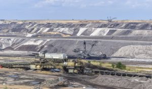
19. Mining
Mining highly relies on GIS for analysis. When LiDAR technology chips in, the mining is explored and understood further. The area that is mined can be used to calculate the volume of the minerals. The area can be obtained by using LiDAR
20. Archaeology discovery
DEM that is created from the LiDAR is used in the GIS system for analysis and interpretation. Therefore the archaeologists understand where to get hold of the information evidence.
21. Stormwater management
To prevent water from the ice melts and the runoff water from running into the settlement areas and streets, the LiDAR data is used to get the elevation and the angle of the ground. GIS brings into the map the settlement areas and the streets.
22. Tsunami coverage area
A tsunami can be disastrous. Through the elevation measurements on the map, the Tsunami prone areas are identified. Through sea details and land, a comparison made using
LiDAR data which is analyzed by the GIS, the Tsunami inundation areas are mapped.
23. Survey tunnels
When roads have to penetrate through a mountain, the LiDAR is used to understand the nature of the tunnel and the sustainability of the tunnel for road passage.
24. Airport infrastructure analysis
Airport zones are analyzed using the LiDAR and the GIS which give a great insight into the model. GIS is also needed in this.
25. Railway infrastructure analysis
Railway lines and the surrounding environment characteristics are jointly done using the LiDAR and the GIS help get the best understanding of the lines of transport.
26. Urban management
Urban areas have to be analyzed faster using the LiDAR which executes the analysis faster when combined with GIS. This helps understand the area and the city well.
27. Measurement of the wind speed
In wind farms, the LiDAR is used to measure both the speed and the direction of the wind.
28. Imaging
LiDAR is used to produce a 3D model of nature and different areas. This is done using fast gated cameras. These images find great use in GIS analysis.
29. Military base construction
Military areas are constructed using the information analyzed using the GIS and LiDAR analysis information. Topology and the elevations are used to analyze the area and determine the best areas for the military.
30. Oceanography
GIS also wants to analyze water masses including the ocean. Information of what lies deep in the water can be obtained by having the LiDAR used in the imaging and analysis.
31. Atmospheric studies,
The concentration of oxygen and other gases in the atmosphere also needs to be understood clearly. This needs the LiDAR to analyze through the technical use of the wavelength comparisons. GIS maps the findings.
32. Geology
The study of the rock structure and the formation is highly preferred in the GIS when doing the spatial and geographical analysis. Therefore through LiDAR GIS is able to get valuable data.
33. Cellular network mapping and planning
GIS looks into the information of both human and natural activities. Therefore using the LiDAR the understanding of the distribution of the cellular services can be analyzed.
34. Planning and property maintenance
The use of GIS n=and the LiDAR can help identify where to place some properties and how to use the area effectively. You can understand where to strategize the industries and the constructions.
35. Architecture
Built areas can be analyzed using the imaging done by the LiDAR and this will help understand changes when doing urban planning
36. Glacier formation analysis.
Images obtained from LiDAR can be used to analyze the volumetric alteration on the ice and the glacier on the mountain. This is mapped using the GIS.
37. Solar energy planning
Where solar energy features and solar tapings can be placed is also determined by the LiDAR. The location and other details can be analyzed by the GIS.
38. Viewshed analysis
The digital elevation model generated using the LiDAR is the most important aspect of this calculation. This analysis is one major function in the GIS.
39. Determine the mining method.
When the elevation is analyzed and the results computed the volume of the minerals and the nature of the location is used to help determine which method will be ideal for the mining.
40. Cloud measurement and mapping
The cloud concentration and the coordinate information is determined using the LiDAR. This is therefore important in GIS mapping and imaging.
41. Sewer and manhole system analysis
When measuring the pollutants and the most dangerous areas for man to live, the detection of the gases and the atmospheric contents is done using the LiDAR. Therefore this helps make the areas located and designated in maps drawn using the GIS.
42. Drainage analysis
Areas that have high chances of water retention are identified using elevation details and soil structure details. The two are captured using the LiDAR software which is the ideal for complementing the GIS is information feeding on the maps.
43. Traffic congestion
LiDAR sensors are used to keep getting the information from the traffic often and this information is used in GIS when it comes to project evaluation. Areas prone to traffic can be mapped using the information obtained using the LiDAR.
44. Disease and epidemiology
GIS maps the human threats and disease distribution over the planet and the locations. Using the LiDAR in health facilities has helped monitor disease and epidemiology distribution. This is mapped and analysis is done by the GIS.
45. Power and energy distribution
Power lines and the areas where these amenities have been extended can be analyzed with both the LiDAR images and the GIS software.
46. Soil profiling.
LiDAR images tell much information concerning the soil, components, underlying features and this is an important factor when it comes to GIS. This information is mapped for use in agricultural planning and decision making.
47. Meteorology
During the spatial analysis and representation of the data in GIS, meteors can be an important factor to study. LiDAR helps investigate and take photos and images of these areas so as to map them. Some areas looked into including the clouds and the atmospheric composition.
48. Crop mapping
Through the use of GIS analysis, the location of which crop to grow in the area can be determined. LiDAR helps get the data of such crops by taking images and the elevations of the places.
49. Education sector
LiDAR is used in the GIS classroom for educational purposes. Both when combined are used to analyze maps obtained from the existing database. The students make use of LiDAR products in GIS classrooms. LiDAR maps and the images are used together with GIS.
50. Climatic conditions
Areas with different climatic conditions can be mapped when GIS used together with the LiDAR. The LiDAR takes images of the underlying features which include the vegetation. Through this vegetation information, the climatic and vegetation zones are mapped.
LiDAR has found wide applications even outside the GIS field. It is one of the most important technical aspects that the world has in this era.