GPS is short for Global Positioning System, meanwhile, GIS is short for Geographical Information System. It is unsurprising to see most people confuse themselves between GIS and GPS, given that both involve satellites to collect data which is interpreted and analyzed by software.
Global Positioning System (GPS)
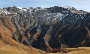
1. GPS is used to find precise locations on the surface of the planet by pinpointing the exact latitude and longitude. It is able to do this by means of using a network of satellites in space that communicate with one another to assess a particulate position on the globe. No individual satellite is capable of being able to determine every single location on the face of the Earth, which is why it requires multiple satellites to get the job done. The satellites work by transferring radio signals to one another.
2. The GPS system makes use of the simple transmitter and receiver model to collect information. Trilateration is the name of the process by which receivers which are present on the ground receive signals transmitted by satellites to determine a particular position on the Earth. In order to pinpoint a particular position on the globe (especially if it is a moving target), a vast combination of satellites (usually 24) and receivers is required to communicate information back and forth in the form of radio signals.
3. The GPS system is key to our daily functioning indirect ways (determining our immediate location, navigating to a particular place, sharing our live location with others) and indirect ways (software and applications that require the use of our location such as Uber and security monitoring systems), even though it was first developed in the 1960s by the US military. The GPS system is now crucial to transportation, the movement of both people and items from one particular location to another anywhere from the aviation to trains.
Geographical Information System (GIS)
1. GIS, on the other hand, is a real-world piece of software that is used to process the data that has been received from location systems such as GPS. GIS is responsible for converting data into information by analyzing, interpreting and carefully assessing so that it is useful. The focus of GIS is to make use of geographical science to help us understand the physical world and its topology. It is a more sophisticated and complex system compared to GPS, which only provides GIS with data for use.
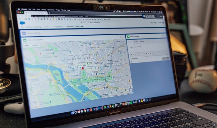
2. GIS is used to process spatial locations, and organize information by deconstructing it into multiple layers. This information is effective in creating useful visualizations of the physical contours of the landscape by means of using maps and 3D environments. GIS also aids in the discovery of new pieces of information about the physical world such as patterns and relationships that were not known before. For this reason, GIS is typically used to perform in-depth analysis by deconstructing and breaking down the physical world into a more organized fashion that is easier to understand.
3. GIS is used to create maps that visually describe physical location and process multiple forms of data by means of spatial location, such as complex imagery and converting data into graphs, tables and spreadsheets. Thus, it can be understood that GPS is more concerned with finding the exact position of an individual and keep a track of moving individuals, whereas GIS is more concerned with location, topology, and utilities of a physical location. Meanwhile, GIS is a data management tool that does not just collect and store information like GPS, instead, it performs complex analysis on it to make it more useful. GIS is also used for high-end purposes that only advanced computer programs and software can do such as 3D graphics terrain modeling to create a visual and life-like understanding of a geographical environment.
4. GIS has traditionally been used for location analysis whereas GPS is mostly used for location determination and merely performs the analysis. For example, GIS may be used by an event management company to determine if a particular new location is ideal for hosting the next biggest event of the year. GIS is also used for proximity analysis where it helps to understand how to positions on a map may be correlated to one another and how close/fare they may be to each other. GIS is also used for visual geographic mapping where it is used to visualize data to better be understood and help in decision making. All of these are functions are key distinguishing features of GIS which help us understand how it is different from GPS. GPS cannot be used to perform such tasks because it is simply a constellation of satellites aimed at constantly monitoring the Earth’s surface to calculate data such as longitudinal, latitudinal and elevation positioning.