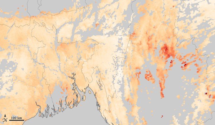
Applications of remote sensing in air pollution
The launch of a NASA Terra satellite back in 1999 was the perfect beginning of the earth's atmosphere remote sensing. Since then, space platforms such as CALPPSO, ENVISAT, AURA, Aqua,…
0 Comments
January 7, 2020