The data gathered from images through radioactive processes is a brilliant technology, this is called remote sensing. Remote sensing does not need direct contact with the object in order to extract data, it can be done from far away by accumulating sensory signals of the radioactive particles that are out there in the air. Remote sensing is done in many areas for a variety of reasons. It has experienced positive and effective output on the operational platforms of multiple industries. Mineral exploration is one of the sectors where remote sensors have shown immense support and effective results.
Landsat is a very popular technology that is being commonly used for remote sensing by the miners. Landsat satellites are very good at detecting electromagnetic sensors in the atmosphere and such patterns of radioactive movement provide an indication to the researchers about the characteristics of the lands. Basically, the light which is reflected from the earth’s surface is recorded by the sensors within the framework of the electromagnetic spectrum which provides the necessary data. Lidar is also a very effective method that involves surveying. By using laser light, the electromagnetic radiation is being measured which provides better areas of determining the attributes of the earth’s surface in terms of the minerals that might be present there. Some important applications of remote sensing in mineral exploration are highlighted below:
1. Field Spectroscopy
Field Spectroscopy is highly effective in areas where there is a greater composition of vegetation present on earth. It determines the quality of the soil and also measures the patterns of flow of water through the rocks. Such measures allow researchers to indicate what type of minerals may be present in those areas. Like most others, this method also uses the electromagnetic spectrum and with the radiation level detection, enables the discovery of matter components in the surrounding areas. The thermal infrared technique is also a very effective one where the sensors detect the geothermal energy of the earth’s surface. This is good for the detection of the length that can be dug inside the earth’s surface to discover certain minerals.
2. Collection of Data imagery
Mineral exploration may have several parts. The first part is always about collecting data. The next part is usually about how the data is transferred and translated into a language that explorers understand. They are often made in the form of images as they help the miners in many ways. Image classification is a very common scenario here. The reflection, absorption, and transition of solar radiation is usually used to create spectral signature. This spectral signature is often used by explorers in different areas to detect similar patterns in lands. This saves a lot of time and money. Remote sensing is therefore very cost-effective and can save the miners a lot of unnecessary efforts.
There are certain agencies and companies that carry a heavyweight of information through remote sensing. Satellite information can be transferred and made available in the commercial markets. Such data collected from satellite remote sensing covers a wide area of the environmental factors that determine the earth’s characteristics all across the globe. Certainly, many mining companies have over the years liaised with such data companies and have worked together in various projects. The remote sensing technology is still developing as more researches are taking place in various laboratories around the globe.
As more high tech equipment is being made available in the market, the remote sensing technologies are getting much better and more functional. For this reason, data gathering projects never stop. With new and upgraded technologies being made available in the market, they are being used to collect more data and much detailed information about the earth’s structure, something that has not been done previously. This makes the mining processes even more skillful and uncovers more prospects to discover more minerals that can be used to better the economic environment of the planet.
3. Mineral potential mapping (MPM)
Areas with Mineralization are usually detected during Mineral potential mapping (MPM). This procedure involves the spatial prediction whose main objective is to delineate areas with varying probabilities of bearing minerals. Remote sensing is very efficient in MPM and it integrates various types of geo-data and spatial analysis to identify areas of mineral deposits. With remote sensing, researchers can establish a conceptual model of exploration, build an effective spatial database, analyze spatially. Data, and combine the evidential maps in order to predict the likelihood of mineral deposit.
4. Reconnaissance Surveys
Before exploration, researchers usually spend time to survey the area of interest for the sole aim of deducing the potential of mineral accumulation. Reconnaissance survey is always the first step in mineral exploration and mapping. Remote sensing studies provide researchers with data and information about the geologic features, settings, drainage, landforms, stratigraphy, vegetation, weathering, and other spectral features. More so, near-surface faults, folds, and traps can as well be unraveled from remote sensing imaging; thus providing clues to places where minerals of interest can be found.
5. Structural mapping
Further studies are usually carried out on Maps deduced from remote sensing surveys. These studies are purely based on remote sensing applications and they are all aimed at improving the existing Maps. Aerial photographs can be used to capture images of mineral and linear features of geological structures. A plethora of mineral resources is usually deposited in faults, folds, and traps. Remote sensing imaging can identify the locations and volume of lithological structures, lineaments, joints, and other important geologic structures. On the whole, remote sensing technology is very effective in near-surface geologic research and structural mapping but is poor in identifying deeply buried features.
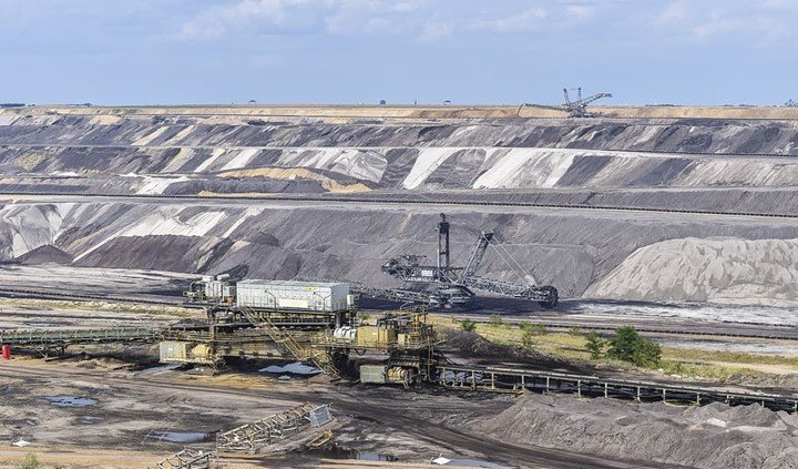
Many private and government-owned companies are always on the hunt for mineral resources. Mining of many forms takes place in the process where the miners go deep under the earth’s surface looking for a variety of minerals that can be used for trade and commerce. There are many geological techniques that are associated with the mineral exploration process. Rock trenching and sampling are very common. Using such techniques a certain type of mapping system is possible to make. With the assistance of remote sensing images, such work can be made further easier, especially for the geologists who are looking for extra information that deals with under earth surface patterns.
The research team spends a lot of time and effort in determining the characteristics of the earth’s surface. With the work of stripping and trenching, the mineralization evaluation can be made into understanding the economic prospect a certain land offers. Advanced Spaceborne Thermal Emission (ASTER) is a remote sensing process that makes the process easier and allows the researcher to gather more information in a short period of time. In such processes, the miner may not have to undergo massive mining operations. Without digging deep into the earth’s surface, the remote sensing information would be good enough in terms of the prospects a certain land carry. This is a very inexpensive process and has been applied by a myriad of researchers in recent years. The benefits of remote sensing are many, it helps miners a lot, especially if they are looking for diamonds and gold at remote locations. It is always convenient to use several remote sensing methods to analyze complicated land scenarios conveniently.


Just so much waffle and nothing specific such and how it might detect individual minerals the any of depth penetration.
Sound more like Micky Mouse just came to town