The GPS is a system that encompasses a network of orbital spacecraft put in place in the late 1970s to the mid-1990s by the U S. Department of Defense that can pinpoint precise locations for GPS-equipped gadgets.
It was initially named NAVSTAR GPS by the U.S. government. The GPS It is a satellite-based radio navigation system owned by the United States government and operated by the United States Space Force, which can selectively deny access to the system.
As a result, many other countries have developed or are in the process of developing their own global or regional satellite navigation systems. Russia has developed the GLONASS (Global Navigation Satellite System). China began developing the BeiDou Navigation Satellite System in 2018, expected to be deployed in 2020.
Other GPS systems include the European Union Galileo positioning system, India’s NAVIC system, and Japan’s Quasi-Zenith Satellite System (QZSS). All these systems augment the GPS to enhance accuracy in Asia-Oceania.
The GPS was invented for military use by the U.S. Department of Defense. It was, however, allowed for civilian use by the Pentagon after advances in technology and new demands on the existing system have led to modernizing the system by implementing GPS Block IIIA satellites and a new system called Operational Control System (OCX).
GPS does not require users to transmit any data. It without internet or phone connections and provides critical positioning capabilities to military, civilian, and commercial users around the world. The system is maintained by the U.S. government and is freely accessible to anyone with a GPS receiver.
Standard Positioning Service (SPS), which uses the coarse acquisition (C/A) code on the L1 frequency, and Precise Positioning Service (PPS), which uses the P(Y) code on both the L1 and L2 rates. Access to the PPS is restricted to U.S. Armed Forces, U.S. Federal agencies, selected allied armed forces, and a few chosen governments.
The SPS is freely available to all users across the globe without any charges. The specific capabilities provided by SPS are published in the Global Positioning System Performance Standards and Specifications.
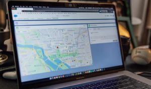
Over the years, ‘ people have developed multiple uses of GPS. From applications as diverse as locating your favorite restaurant, cultivating land, tracking your pet to finding treasure, GPS has become a permanent feature of our lifestyle.
Here are 75 conventional and unconventional uses of the GPS:
1. Bus Tracking
Bus companies and school buses fit their buses with GPS. It helps the bus drivers know in real-time what route to take, the management also tracks the bus movement, and whether they stuck to the authorized roads and stopped at designated stops.
2. Truck Fleet Management
GPS trailer tracking system helps fleet truck management companies improve security, increase efficiency, and reduce costs. The management uses GPS to track and monitor their fleet and equipment. It also provides accurate and detailed reporting.
3. Business Tracking
Courier companies, parcel delivery, security companies, and much other business use the GPS to keep track of their operations. It provides business owners with real-time information about their business and additional relevant information.
4. Prevent Shark Attacks
Yes, believe it or not, GPS is used to prevent shark attacks! An organization called OCEARCH has fitted 50 known large sharks with GPS devices to monitor their movements. This tagging is yielding new information about the mysterious life of sharks, their lifestyle, and their behavior.
5. Tracking your daily run
GPS can help you track your daily run and help you know the best route to run while keeping track of your movement.
6. Tracking your pet
GPS will help you keep track of the whereabouts of your pet. So you have peace of mind knowing that no matter where you are, your pet is safe.
7. Driverless Cars
Google’s program has a program to develop driverless cars, GPS device plots the car’s location, speed, and direction relative to the destination. At the same time, a laser on the roof helps create a digital 3-D model of nearby objects to tag possible hazards.
8. Mapping and Survey
GPS is used in mapping distances on land and underwater. GPS is accurate when over a single point and to establish a reference marker. It can also be used in a moving configuration to map the boundaries of particular features.
9. Militaries around the World
We should have started with this use; it’s the reason GPS was invented in the first place. The U.S. Department of Defense was the first to develop the GPS; over the years, it has been adopted by various military forces around the world to map strategic locations, equipment weaponry; locate enemy missiles, and soldiers during armed combat.
10. Communication
Mobile telephony data transfer and a myriad of communication use all depend on the GPS derivation of synchronized time zones. The GPS satellites are continually beaming signals received and transmitted by cellular phones and other receivers.
11. Tracking people with dementia
As people age, they develop dementia, which can be so chronic that they forget their whereabouts. Older people with Alzheimer’s disease have to be tracked using GPS that is fitted in their shoes.
12. Preventing Car Theft
Vehicle tracking systems use GPS signals to protect cars from thieves. Primarily, the technology works by wiring a small device into a car, truck, or motorcycle and then keeping keep tabs on the vehicle.
13. Civil works
Heavy construction machinery used constructions to use GPS technology in their operations. When constructing highways, marker pegs and surveyors are installed by improvised in-cabin vehicle guidance and control systems. The driver follows the surveyor’s pre-programmed site plan to get the job done.
14. Open Pit Mining
In open-pit mining where satellites can be viewed, accurate GPS is useful for tasks such as machine guidance, grading, dozing, drilling, collision avoidance, surveying, and fleet management.
15. Tracking Stolen Drugs
Robbers and burglars have been targeting drugstores to steal prescription drugs. Oxycodone is a popular target used in the black market for non-medical use. Security officers have stocked pharmacies with decoy oxycodone bottles concealing GPS tracking devices, which detectives use to track criminals.
16. Money Transfers
Banks and other financial institutions use GPS to keep track of local and international money transfers. This provides an audit trail of all their business transactions. Every debit or credit card transaction is recorded in real-time by the GPS.
17. Aviation Industry
Most modern airplanes use GPS receivers to provide both pilots and passengers with real-time aircraft position. GPS also provides a map of various destinations depending on where the aircraft operates. Its also used to keep track of the plane’s whereabouts and instruct the new routes when there are extreme weather conditions.
18. Wildlife Conservancy and Research
The GPS helps wildlife conservationists and researchers to tag and track animal movement and habits. For example, elephants and rhinos are fitted with GPS tracking devices to protect them from poachers. Researchers can also gather information about animals without locating them physically as the GPS transit real-time data through satellite.
19. Ship Navigation
Ship and boat captains use the GPS to navigate water bodies and avoid hidden obstacles that can hinder and locate other vessels. Besides, they help in dredging activities and monitor water depth.
20. Fishing Vessels
Fishing vessels use GPS and sonar to find fish and other fishing vessels, including knowing ocean depth, barriers, and reefs.
21. Agricultural Activities
Farmers equip tractors and agricultural machinery with GPS receiver; this helps in mapping out their plantations and ensure that they farm precisely even when the weather is misty or foggy.
22. Treasure Seekers
Treasure hunters use the GPS to track locations and follow clues on treasure maps to hunt for treasure both on land and underwater. GPS has been used to find vessels that were lost at sea many years back.
23. Keeping Treasured Artwork safe
Paintings like the Mona Lisa are extremely valuable and are a target for thieves. GPS helps keep track of their whereabouts if stolen.
24. Remote Tracking
Backpackers, hikers, and mountaineers spend a lot of time by themselves in remote places; a GPS comes in handy when they need to be found due to an emergency.
25. Hunting
When hunting, GPS markers help identify fertile hunting grounds that you can come back to every time you are out in the woods.
26. Roadside Emergency
In case of an accident or a roadside emergency, you can seek assistance using the pre-programmed emergency numbers on your smartphone. The emergency crew can trace your location using GPS trackers.
27. Emergency disaster response
GPS works in all kinds of weather conditions; this means that in case of natural disasters like storms, earthquakes, hurricanes, tornadoes, landslides, and cyclones, Emergency relief works can reach remote areas cut off by the tragedy to save lives.
28. Highway Traffic Control
GPS is used to control and manage traffic grid looks by advising motorists well in advance which roads are congested. It collects data from all road networks and transmits to traffic controllers and the public in real-time.
29. Special needs
The GPS tracker is used to help people with special needs who may be left on their own. GPS is used to track their location, and help reach them in case of an emergency.
30. Locating Children
Ever lost a child in a crowd? GPS is a lifesaver to parents and family members in groups, it helps family members to keep track of each other’s whereabouts in the crowd.
31. Managing live events
GPS transmits live streaming videos of live events to the world in real-time. GPS helps record activities as they happen, and transmit them to be viewed thousands of miles away.
32. Keeping track of luggage
GPS can be installed to help track luggage or laptops, which helps locate them in case they are stolen or misplaced.
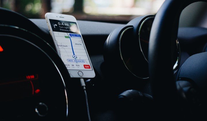
33. Locating your car
Ever failed to find your vehicle in a parking lot? Linking your vehicle tracking system to your mobile device enables you to monitor the location of your vehicle in real-time.
34. Touring Remote locations
It is easy to get lost when visiting new remote locations. GPS comes recommended since it not only gives you accurate data but can also be used as a translocator for rescue agencies in the event of emergencies.
35. Monitoring vehicle speed
GPS tracking provides accurate speed estimates of vehicles or fleet; this information is transmitted to a central hub where real-time vehicle speeds are recorded and kept for future reference.
36. Topographic Maps
Surveyors use GPS to carry out conventional surveys and employ a theodolite and level or a total station. It helps measure geographical coordinates, velocity, and time efficiently, fast and accurately.
37. Immobilizing Stolen Cars
Specific tracking systems allow you to immobilize your car if stolen. The GPS is used to shut down the vehicle even when it’s in motion and will help you to get back, giving you peace of mind.
38. Geofencing
The GPS technology has not only enabled us to track and know directions, but it has also been utilized in geofencing, which alerts you whenever a person or object enters or exits an area. A Geo-fence places a boundary border and notifies crosses the selected region.
39. Rapid Response Alarms
Rapid response Alarms utilize GPS navigation systems installed either on your mobile phone or computer. It notifies emergency response when pressed.
40. Weather Forecasts
Weather forecasts have to be as close as possible to predictions, GPS helps monitor and study atmospheric shifts and formations to help give correct data that is used in projecting temperature levels both on the ground and in the atmosphere.
41. Finding Crucial facilities
GPS helps track your location and provides you with information and data on the area you are scanning. Showing location coordinates of all basic and essential facilities like hospitals, police stations, fire services, schools, hotels, schools, and the like.
42. Measuring Earthquakes
GPS helps measure earthquakes when they occur. It helps measure the quake, it records displacement of stations during earthquakes.
43. Aerial Geo-mapping
Aerial studies and reviews have been boosted by the use of GPS. It has been intensively used in studying terrains and infrastructure. Making it possible to draw is mapping of a region using GPS coordinates.
44. Locating Online sites
You can use GPS to find websites that offer specific services in your country. Certain websites block access from people of particular nationalities. For example, if you need academic assistance in your area a GPS location gets you relevant sites that offer these services in your area.
45. Tracking Criminals
The police also use GPS when investigating criminals. Additionally, it can be used to locate and secure people who may feel that criminals are following them.
46. Protecting Wildlife
GPS helps monitor endangered species from across the globe, from mountain gorillas of Rwanda, The white rhino of Kenya, Elephants, Chimpanzees of Central Africa, White Mountain Leopards of the Himalayas, Humpback whales and many others. GPS helps monitor their population.
47. Tracking Sports
Some sports that have incorporated GPS to track participants include cross-country cycling, skiing, hiking skydiving, paragliding, etc.
48. Efficient Forestry Management
GPS mapping information helps control logging in forests. The GPS provides real-time data of the forest cover and tree planting activities authorities can use this information to monitor and control logging activities.
49. Providing accurate land coordinates
In the case of border disputes, GPS provides unbiased geographic integrated, systematic landmarking and mapping information. It is known to be highly reliable and faster than any other conventional tool giving precise and precise coordinates.
50. Controlling Robots
GPS provides direction to both humans and Robots, but unlike humans, Robots cannot operate without GPS coordinates. It enhances the navigation of mobile robots and makes them applicable to diverse fields such as outdoor industrial work, mapping, agriculture, underwater, in air, and space.
51. Graph Reporting
GPS is used in navigating. It gives is useful graphic reports of occurrences as they happen.
52. Managing Environmental disasters
It is efficient in tracking environmental disasters like oil spills and fires in real-time. Fires and oil spills can occur in areas with adverse weather conditions, and it is essential to monitor the location to offer a fast emergency response.
53. Teaching Science
Most of the sciences taught in schools have practical evidence when using GPS to provide accurate data. Earth scientists primarily use GPS to study landscapes and how they change over time.
54. Warehouse Operations
Storing sorting and shipping large quantities of goods requires a coordinated effort, GPS controlled forklifts, robotic loaders, and GPS track help ensuring every package or load finds its way to the right destination.
55. Private Cars
Car owners can also use the app. Modern cars come fitted with a factory GPS that helps you find directions about where you are.
56. Computerized Art Drawings
GPS tracker and mapping software can be used for drawing digital maps that use grid structures of city streets to create curved lines of different cities.
57. Protecting religious Objects
GPS Security provides churches and other religious organizations a device that either sends a text message or email if a sacred artifact is stolen giving off a signal so that police can track down the thieves
58. Determine Earth Velocity
GPS is used to determine the earth’s position and its velocity from space.
50. Navigating Space shuttles
Space shuttles use GPS. The orbiter needs to know precisely where it is in an area, and to other objects, it has to know where it is and how fast it is moving. The orbiter uses GPS and uses several gyroscopes to reposition itself and avoid collusion.
60. Aircraft Autopilot
An autopilot allows a pilot to fly an airplane without continuous hands-on control of the aircraft. The pilot inputs details like a heading, hold mode, or an altitude hold mode. Autopilots use computers and GPS to correct the aircraft’s position.
61. Helping Teenagers
GPS Apps are installed on teenager’s phones to help them locate birth control clinics and have access to condoms.
62. Sports Coaching
Sports coaches can train their players better using GPS, which records all their movements and activities that help the coach know where to improve their skills.
63. Taxi Firms
Taxi firms are releasing apps, creating a more convenient service for customers, and eliminating the need to contact the operator for an update on their vehicle’s location. Uber is a good example that employs GPS tracking in its process, giving customers real-time data on their vehicle’s site.
64. Logistic companies
Logistics companies supply to hundreds, if not thousands, of items to recipients every week. GPS helps them to coordinate these activities and efficiently monitor the location of every vehicle making timely deliveries.
65. Limousine Rentals
Limo rentals for parties or executive transportation use GPS. Business owners can keep track of the vehicle’s location to ensure productivity and time management
66. Petroleum Products and LPG
It’s essential to secure and protect the driver and other drivers on the road when transporting petroleum products and LPG. GPS tracking allows monitoring of the vehicle’s location and condition.
67. Renting Bicycles
It is used in Cities and places where people rent out bikes. GPS ensures that anyone who rents a bike returns it to its proper location at the right time.
68. Law Enforcement
GPS helps maintain law and order when an incident occurs the nearest law enforcement officer is located by GPS which helps in responding fast.
69. Managing Company pool cars
Providing employees with vehicles requires monitoring. GPS fitted on the tracks of the vehicle and monitors the vehicle’s location, making sure that employees stay on task and not use the vehicle for personal errands.
70. Utility Companies
Utility fleets that incorporate GPS fleet tracking reduce fuel costs. Fuel cost affects budget items for utility companies. GPS fleet tracking helps utility fleet managers to monitor routes and the location of their technicians.
71. Landscaping
GPS fleet and equipment tracking can be used to efficiently landscape. GPS tracking helps you to know how long your crews are at each job site, and know if your vehicles or equipment are out on the job after-hours.
72. Car Rentals
Vehicle Rental Business is exploiting the use of GPS. A significant concern for rental companies is to make sure that their vehicles aren’t misused. They offer better services by incorporating GPS. For example, monitoring of driver’s behavior, accidents, and speed alerts. GPS ensures rental companies keep their vehicles safe.
73. Ocean and Marine Monitoring
Marine environments can be some of the most challenging navigation conditions in the world. Marine integrators rely on GPS to ensure their equipment performs when needed most. GPS provides precise, accurate, reliable positioning measurements for diverse marine applications.
74. Drenching and Hydrographic mapping
GPS is used for Precise and cost-effective dredging systems for port operations and waterways. It is also used for Hydrographic survey systems for mapping of the ocean floor for commercial and research applications
75. Vessel Docking
GPS is used in Relative positioning and heading information for barges, vessel positioning and automatic docking systems, Precision navigation through narrow passageways or congested marine traffic
These are some of the uses that GPS has opened up to different industries. As technology advances, GPS becomes more and more imbued in daily activities. Soon every facet of our lifestyle will be GPS assisted, managed, or controlled.