Several works in civil engineering are carried out in an unfriendly and complex environment which makes it difficult for the personnel to efficiently operate. But with the help of GPS or Global Positioning System, the work is carried out easier. Its ability to provide accuracy at centimeter and sub-meter levels in a highly cost-effective manner has changed the entire industry of civil engineering significantly.
This accuracy and free availability globally of the GPS signals for timing and positioning when combined with cheaper receiver chipsets makes GPS amongst the top preferred solutions for a wide range of applications when it comes to the civil engineering industry.
Here are some of the most growing applications of GPS in civil engineering.
1. Road transportation
Since there are high numbers of GPS receivers that are sold globally, the applications in rad transportation are by the majority of the users of GPS. These applications can be for tracking of freight, commercial fleet management, public transport monitoring, services of a taxi, navigation and dispatch, emergency vehicle location and passenger information. The owners of private cars are also widely adopting the in-built GPS system in their cars and most of the manufacturers of the automobiles are into releasing newer vehicles that have an optional fitted GPS.
2. Aviation industry
When it comes to commercial aviation, most of the aircraft today make use of the GPS navigation and it is widely being used for a non-precision and initial approach for airfields. The Automatic Dependent Surveillance-Broadcast or ADSB is under development across the globe for future technology when it comes to controlling air traffic. This includes a specific aircraft calculating its position using the GPS signals and then sending them to the other aircraft that might be nearby. The GPS signals are also widely in use for the unnamed aerial vehicle navigation. This is solely for professional use, for example, in the aerial surveying and resource mapping.
3. Rail and shipping transport
It is not to a surprise that both railways and shipping transport make use of GPS navigation widely. These applications include inshore and ocean navigation, approaching ports, dredging, docking and harbor entrance, AIS or Automation Identification System, VTS or Vessel Traffic Services, handling of cargo and hydrography. When it comes to the railways, the applications include information of the passengers, rolling stock management, signaling of cargo tracking, preventing the doors from opening until there is carriage alongside the platform, train integrity and approach for the level crossing.
4. Applications in science
Science and civil engineering run parallel and the applications of both are widely used by people around the globe. These applications are widespread and include monitoring of atmosphere, several studies related to animal behavior, climate research and meteorology. The GPS signals are also used for the mapping of the land area when it comes to fisheries and agriculture. It is also used for monitoring the yields, harvesting and spraying, precision crop planting, and control of autonomous vehicles and monitoring limits of fishing.
5. Security applications
GPS is also used for several security applications and some of them include the tracking of different vehicles, several containers, cargoes that are highly valuable and converting the suspect tracking.
6. Guidance for the heavier vehicles
GPS signals are being used increasingly for guiding and tracking heavier vehicles when it comes to civil engineering applications, such as construction and mining. Consider the following example. When a highway is to be constructed, marker pegs and surveyors are been replaced with a guidance system of in-cabin vehicles and several control systems. These are used in graders, excavators, bulldozers and several roads paving equipment which allow the drivers for following the pre-programmed and pre-planned site plans for the surveyors. This helps in achieving the closest of the tolerances for leveling, positioning, and gradient.
When it comes to the open-cut mines, these GPS signals are been integrated into several applications that are been developed by several Multinational Companies. These are used for several mine asset management systems and vehicle tracking and guidance.
Well, in these applications that are being used professionally, the information of the GPS signals is captured by the sophisticated and high-end IT systems which are then meshed with several other engineering applications for providing multifunctional control and guidance.
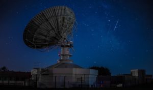
7. Mapping, surveying, and geophysics
Professional and survey-grade receivers of the GPS signals that are capable of capturing signals from the L1 and L2 frequencies of GPS are used widely for positioning th4e survey markers, bridges, buildings, and many other larger infrastructures. These GPS signals are increasingly been used in mappings, such as aerial mapping and several other GIS applications or Geographical Information System. Coming to geophysics, these GPS signals are being used for time-stamping several seismic activities and monitoring the changes in the position f the sensitive physical formations like earthquakes and volcanoes.
8. Financial services
The financial systems across the globe are in need of the systems for precision timing for scheduling and prioritizing the international as well as the local transfers of money, trades and settlements and for providing a proper audit trail for various financial transactions. Let’s take an example. The time signal which is provided by the atomic clocks which are on the GPS satellites is being used by several financial institutions across the globe to provide time stamps and dates for the electronic fund transfers. In most developed countries about 80% of all the retail transactions make use of debit or credit cards. There are millions of transactions been carried out each minute and the higher levels of the accuracy of timings are becoming a critical and essential component when it comes to the networks for financial trading.
9. Telecommunications
The timing of the GPS signals is very essential for several applications related to telecommunications, especially the ones that include mobile telephone networks. The synchronous technologies are of much more effective than the asynchronous ones, but require a specific time source with correct accuracy, reliability and stability for operating with much effectiveness. The GPS satellites help in providing this effectiveness.
The ground-based clocks are much accurate for achieving this, but the synchronization of several such clocks can turn out to be problematic. GPS signals allow this derivation of the synchronized time by resolving signals from several sources of atomic clocks at the locations known.
10. Other activities
The lower cost and hand-held receivers for the GPS signals are widely available and are used for several social activities. Some of the most prominent applications include navigation in cars, hiking, cycling, skydiving, paragliding, and many such gaming activities.