Remote sensing in agriculture refers to the acquisition of information from agricultural material or products without touching them. It has become a very valuable tool in monitoring, evaluation, and management of agricultural resources. The phenomenon has many applications such as geology, surveying, forestry, photography and, many more. However, the field of agriculture has more uses for remote sensing than most sectors. The most common tool that you can use for remote sensing is aircraft or a satellite. Besides, the recent advancements in technology have led to the development of sophisticated drones with high-end cameras and sensors. The drone can travel at a high speed while important information from the farms.
Using drones as the ultimate remote sensing tool is much cheaper compared to the use of aircraft and satellites. Furthermore, drones can take close aerial pictures that display detailed information on the plants. For instance, a drone can go very low to take a shot while planes cannot. But that does not render those tools useless in the agricultural sector. For example, satellites and aircraft can collect more data over a wide area which can be very useful in Agriculture. A good example is when studying the patterns of weather.
Applications of remote sensing in Agriculture
1. Assessment of crop progress or damage
Remote sensing technology is mostly used in Agriculture to access progress or damage. It helps to asses, especially inside large farms. All data is saved in storage that researchers and farmers use to study the crops.
2. Crop identification
Crop identification has been made easy by the remote sensing technology. For instance crops under observation might show mysterious characteristics. Data is collected from such instances and sent to the lab for further studies. In the lab, new aspects are studied to get accurate results. One good example of such an aspect is studying crop culture.
3. Crop yield estimation and modelling
Experts and farmers can easily predict the amount of yield that will be produced by certain resources. Furthermore, they can predict the amount of time to be taken other resources to be used. Remote sensing data allows farmers to model and develop better strategies that will likely improve the yield.
4. Pests and diseases infestation identification
Remote sensing has played a major role when it comes to the control of pests in agriculture. It helps with the identification of disease and pests hence experts can come up with the right mechanisms. Data collected over time is compared to match diseases using the symptoms hence controlling it becomes easier.
5. Soil moisture estimation
Measuring soil moisture couldn’t be easier than using remote sensing techniques. It works by exchanging data with the soil moisture and then determining the quantity. Data drawn from such activities is analyzed to determine the right crops to grow.
6. Crop production forecasting
Farmers can predict their production return over an estimated area in a given season. No matter what the season is, they can easily obtain data of their projected returns. Besides, experts are also able to predict the quality that yields will produce under any conditions.
7. Planting and harvesting dates identification
In the past harvesting, date estimation was done by guesswork. However, with remote sensing, there is enough data to predict the exact harvesting data. Thanks to the predictive feature of this technology farmers can prepare on time. It can achieve that by studying weather patterns and considering other factors such as soil
8. Soil mapping
Soil mapping is very important when it comes to the production of high yields in this field. Better soil mapping leads to high-quality yields. Remote sensing provides important information that can be used to match crops with the best soils.
9. Irrigation management
Since remote sensing provides details of the soil moisture, farmers manage irrigation with ease. With this information, one can also identify parts that have not received the right amounts of water.
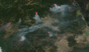
10. Droughts monitoring
One of the major functionalities of this technology is to monitor the weather. Draught patterns are not excluded hence the data is analyzed and transmitted to farmers for awareness. Rainfall patterns are also monitored in such a way that you can tell the difference between two rainfalls.
11. Crop condition assessment
The assessment of the health of each crop is easy to carry out using remote sensing. If any crop is stressed, remote sensors collect data and send it to the personnel in charge. Experts use this data to determine the quality of the crops.
12. Crop acreage estimation
Estimating the farmland on which crops have been planted manually is a very hard task. However, with remote sensing techniques, one can easily figure out such details within a short time.
13. Soil management
Soil is a very important factor when I come to producing quality yields. So management of this resource is what determines the final product. Remote sensing helps to identify practices that can be used to improve the quality of the soil.
14. Land mapping
Land can be used in many different ways in Agriculture. Remote sensing collects data that helps to map lands for agricultural purposes. For instance, it can be for landscaping or crop growth. Because different soils are useful for different purposes then the land mapping is very important.
15. Precision farming
Remote sensing has helped with the improvement of precision farming over the years. Precision farming is very important because it produces healthy crops. Furthermore, the crops grow within the given period hence optimum harvests are realized.
16. Climate change monitoring

Climate change can affect agriculture in both a positive or negative way. However, using remote sensing techniques farmers can capitalize. They track climatic changes and use them to their advantage. For instance, they plant crops that can perform well depending on the climate. Furthermore, they can devise ways that make some crops drought resistant. Experts observe the climate to decide crops that will perform better in the affected areas.