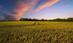
The application of remote sensing is revolutionizing in various industries. Remote sensing has been used in the various sector to gather information, with the use of such information, a lot of research and development takes place to improve the standards of operation. The transportation sector is not far away. Spatial data and remote sensing technology have very wide applications in highway security and technology. In fact, the application of remote sensing in transportation is more profound than in any other industry. In many areas, it is considered to be an act of information gathering system. With the use of the data collected from remote sensing, transportation planning can be improved and redesigned to make the lives of people much easier and convenient.
The data from remote sensing is collected mainly from two areas, one is from the aircraft and another is from the satellite.
1. Earth Observation through Satellite
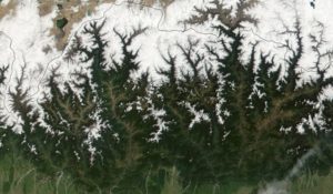
The satellite sensors are highly effective at uncovering the necessary elements of data on the ground. With the use of the electromagnetic spectrum, a certain data package can be gathered that provide information about certain geographic locations. For example, if there is a free area that the government plans to use for building roads or perhaps rail tracks, the ground elements such as soil and its moisture information can be gathered. This goes a long way in boosting the success rate of the project. In addition, more information about the geothermal energy process can also be uncovered to determine what type of materials are suitable for the ground to be used in the road building process.
In broader terms, the wider application of the environmental factors can also be taken under consideration through various methods of remote sensing. Future forecasts such as the impacts of vehicles running on a particular area, in the long run, can also be calculated. In this scenario, the number of carbon emissions and its wider environmental impact can be considered through the use of remote sensing. Satellite remote sensing data have provided researchers with a vast array of information about the impacts of climate change in the transportation sector. With this information, many vehicle companies are also making compromises in their manufacturing processes. This is to deal with the dangers of global warming and the wider environmental effects that can affect people in the long run. On the whole, remote sensing and spatial data analysis are very efficient in curbing disasters, accidents and other dangers that are inherent on the highways and airlines.
2. Space Platforms, Town planning, and Architectural designs
The data uncovered from remote sensing can be used in a number of ways to help architects design roads and highways. The recently uncovered data is always helpful for researchers and designers to implement innovative ways to plan the transportation system. The major emphasis has been put forward on the new types of vehicles that would be running on the roads in the coming decades. Since a majority of automobile companies have adapted and have been complying with the sustainable development standards, new cars that would be released in the market need to have compromised roads for its longevity. Although the realistic attributes are still a cause of concern, the data gathered from remote sensing are allowing researchers to develop new technology that causes little or no harm to the wider environment. Remote sensing has been able to delve into the future to unravel the needed innovations in the transportation industry.
Furthermore, data gathered from remote sensing also provides assistance to plan the road transport system effectively. For example, certain bus routes can be well crafted and remodeled so that a much faster and convenient service system is provided to the system. Underground railways are also impacted by the data gathered, where rebuilding and remodeling can change the way citizens function and move around the city. More importantly, it allows new cities to be built by assessing the environment effectively.
3. Environmental Assessment Process
A definitive form of assessment process concerning the environment is extremely mandatory before developing any new roads and highways in this modern era. Climate change is definitely a reason. Member countries of the United Nations, who are complying with the standards of the sustainable practice have to very strictly adhere to such guidelines. In order for the assessment to take root, data gathered from remote sensing is highly essential and vastly effective. Such data is providing information that is allowing the government to take different majors on the ground in order to combat environmental impact. For example, farming in areas where the ground has very little depth allows the soil to take time to settle down and be strong. On a strong ground, it is easy for laydown foundations to develop a structure for roads and highways. By gathering important data such as this, the transportation industry is bound to have long-lasting roads.
4. Transportation Infrastructure
As mentioned before, the traffic system and patterns of citizen movement can be measured through remote sensing. A vast amount of data is gathered on the large cities of the world, where through remote sensing, the technologies determine the patterns of behaviors of a citizen who are moving from one place to another. In this scenario, Architects can plan, design and remodel new traffic routes, highway networks and most importantly an effective public transportation system for the convenience of citizens. This is highly essential when new cities are built or perhaps certain cities are upgraded with new roads and highways. Moreover, such remote sensing data also provide essential information to make the traffic management system more productive. Certainly, the growth of the transportation network has been an important element of the urban growth process. Remote sensing data uncovers all the aspects when certain areas are cleared to make a new transportation network.
Wrapping Up:
There are a variety of areas that concerns transportation planners in these days and age. Most importantly, the concern on the environmental impact is always high and very seriously looked at. To assist such seriousness many agencies have invested heavily in remote sensing data so that the output is more productive and positive.
Engineers, town planners, and Architects make use of Remote sensing data in the identification of road terrains and road networks. Road surveillance, road design, and security are also given face-lift.