Remote sensing is a revolutionary method of data gathering. The technology is achieving evolution in terms of upgrades each year as more devices are brought forward. As the Earth’s satellite becomes more technologically advanced, it is capturing more images and sensing varied radiations that are there within the atmospheric realm of the planet. The solicitation of remote sensing in forest management has become more important for various organizations and agencies. Data is an important factor that assists in research and development processes to take place. It not only makes better management practices but also pushes better ideas to resolve problems and remodel scenarios for further convenience of citizens. Forest management, therefore, plays a vital role in assistance to a lot of factors of operations concerning various industries.
1. Sustainable Practices
The threat of climate change has been causing major alarms to people around the globe. A lot of pressure groups are creating intense gravity on the various industries to take the future environmental impact of their practices seriously. In this regard, the concept of sustainable practices has been developed that takes concerns about varied factors in ways the ecological environment of the planet can be preserved. The role of deforestation has been looked at in an in-depth manner and with a more serious attitude. However, the population still needs resources in order for them to lead a healthy and convenient life. For this reason, a complete remodeling of the several management processes is needed, remote sensing provides a clear picture of what to do to face the environmental challenges of the future.
2. Studies of Forestry Conversion
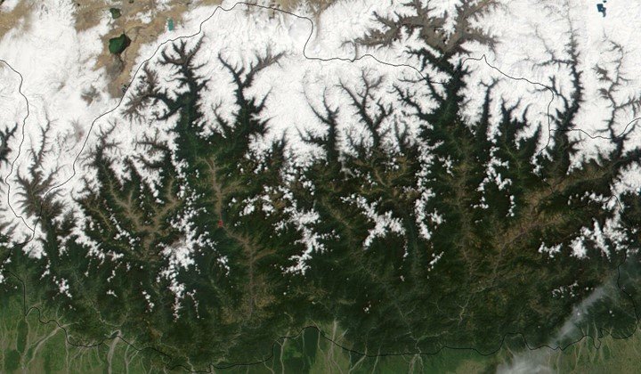
The spatial change maps ate very essentially in the monitoring of forest encroachment. This is aided by the data deduced from multi-temporal satellite and digit analysis. More so, the logical operations, as well as the differencing methods, can be used in checking the quick rate of forest destruction. Extensive data can be used to ascertain the rate of degradation of the forest and to what percentage is left. With these results, researchers can recommend solutions to imminent deforestation and solutions for forest encroachment.
3. Assessment of Resources
Resource assessment is an element that brings forward major new upgrades in the management system. For example, through the use of thermal energy, remote sensing devices can pick up data on how the environmental factors react to certain forces. In this manner, how much deforestation is needed to meet the demands of the population can be calculated. Resources can, therefore, be extracted and cultivated accordingly so that no accesses are being done. There is still work going on to totally stop the deforestation process and through further research from the ecological environment, alternatives can be found and discovered to be made available in the market as valuable commodities that assist human lives. It is still a long term project, where upgrades in technology are helping the researchers to find new ways and better solutions to save the environment from disaster.
4. Forest Surveillance
Remote sensing also allows the forest departments to undergo proper monitoring process of the areas. With the data received from remote sensing, the management department can figure and utilize the forest resources accordingly. In this aspect, the team can determine which areas of the process and up to what percentage of the entire forest has qualities of degradation and so forth. The perception of land that can be utilized for vegetation can also be determined through the data provided from remote sensing applications. It further enables the department to map out the entire forests in an in-depth manner with little or no variations of errors. Such mapping data can be further passed across various organizations that would be interested in certain investments in the area for multiple reasons. The mapping process indicates and allocates several areas of forests in terms of open area, closed areas and degraded areas. The percentage levels of such areas provide clear information about what to expect from the different land structure of the forests.
5. Mapping & Data Collection
The mapping and data collection also indicate a vital factor related to the land distribution of the forest. There can be areas in the forests that are dense and hard to explore by people. Remote sensing can uncover various data from those areas in terms of what type of plants and tree species are present there. With detailed information about the type of plants and trees available in those areas, researches can determine what type of minerals can be extracted. This mineral can be used for many purposes, from medicine to inventions. Determining the composition of tree species is an integral part of the mapping process. It provides information about the earth’s surface and what to expect from the area if certain alternatives are being placed. This provides further assistance to scientists who would like to go deeper at various levels in the research processes. Certainly, the behavior of tree roots underneath the earth’s surface is a major case of study that has been developing among scientists in recent years. Remote sensing data provide a myriad of help to such research work where they can go deeper into upgrading their knowledge of plant and tree behaviors in forests.
Wrapping up
The Earth has a lot of forests. These forests are incredibly gifted with many natural resources that have not been utilized yet. Remote sensing data certainly provide the researchers with information on how such resources can be discovered and how they can be used for the benefit of people. However, the harmful impacts of the ecological environment are also needed to be taken care of. The forest management team has to be very careful about how the forest data is being used by various organizations. In the process, the practice of sustainability has been made mandatory by the United Nations in such scenarios. It is evident that the resource management process has to be allocated carefully so that environmental disasters don’t happen. The old ways of resource extraction have to be eliminated and new ways have to be brought forward for a better future in the long run.