The world’s water bodies have been getting depleted of their fish resources due to overfishing, prompting the implementation of measures such as aquaculture. Remote sensing methods and technologies find various useful applications in the field.
Remote sensing, in this case, involves all the large-scale data collection methods that consist of modern, non-destructive technology. Here are 10 such applications as used in aquaculture.
10 Applications of Remote Sensing in Aquaculture
1. Fish Detection and Mapping
The identification and mapping of fish, especially those that tend to school together, are very important when they are about to be harvested. This information enables more accurate targeting. The basic method of finding fish involves visual spotting, which can be done from an airplane or through UAVs. For greater and more accurate analysis, sonar wave analysis is used, the same use in echo sounding. There have also been recent applications of LiDAR technology, which can penetrate clear surface water up to a depth of 16m.
2. Determining the Number of Particles in Water
Sunlight penetration is the boon of life, even in artificial lakes and fisheries. Too much matter in the water reduces its opacity, or the ability of sunlight to penetrate. Farmers have to keep checking on how clear the water is using a variety of methods.
Active sensors, such as laser-powered LiDAR operated from low-flying aircraft, are one of the best ways to accomplish this. The water could also be turbid and cause a lot of floating material, in which case it also helps to know what that material is. For that, electrical resistivity tests are used to find out the nature of floating debris.
3. Determining Biomass Density
As opposed to mapping fish populations, determination of the biomass in water involves every type of species present. It helps to determine what food chains are going on in the area of interest, thus influencing decisions such as what fish should be introduced.
In this case, also, a variety of methods can be employed depending on a number of factors. LiDAR and Sonar Imaging are two of the most common methods used to accomplish this.
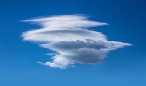
4. Mapping Water Temperature
Fish are very sensitive to temperature. For some species, it affects breeding, while for others extreme temperatures threaten their entire survival. For large water bodies, most governments can provide a thermal mapping of the world’s major oceans, lakes, and rivers.
Remote temperature sensing is achieved through the use of infrared radiometers. These devices detect radiation which all bodies give off. By measuring the amount of radiation, they can give an accurate figure of the surface temperature of a water body.
There are also smaller IR radiometers that can be mounted on aircraft, UAVs, or handheld. The main advantage of these handy gadgets is that they operate from a distance and don’t need to get in contact with the water. However, they’re not good at measuring the temperature at great depth.
5. Determining the Chlorophyll Content
The presence of microscopic plant life in a fish farm, ocean, or even lake indicates a healthy ecosystem. Depending on the species being farmed, the farmer would want to know how much plant life is in the water by measuring its Chlorophyll content.
For some time, Chlorophyll could only be measured through direct methods, but NASA launched the SeaWiFS instrument on satellites. It calculates the surface chlorophyll concentration and photosynthetic activity on all major oceans and lakes.
6. Salinity
Farmers who specialize in shrimp, prawn and other types of seafood need information about ocean water salinity. It can vary from place to place and from season to season, thereby affecting production.
Satellites make use of radiometers to measure surface salinity. They do this by measuring the ‘brightness temperature’ or the amount of reflected light in a given direction. With that information, they can determine both the salinity and temperature of ocean water.
7. Finding the Best Places for Cage Culture
Cage culture is a very popular method in some countries for raising both freshwater and saltwater fish, seaweed, crustaceans, and more. However, it needs to be done in sheltered areas that are free from strong currents, winds, and predatory animals.
Remote sensing, especially through the use of satellite data, can provide this information and more. It can help provide various types of maps of a water body to be used to determine its suitability to cage fishing.
8. Mapping Water Depth in Shallow Areas
Also called bathymetry, this is a function that is very important for mapping coastal beaches, sandbanks, coral reefs, and planning ideal spots for cage farming.
In clear waters, LANDSAT satellites can measure the reflection from both the water surface and the ocean floor. This information is then used to calculate the depth at those places. There are also more complicated methods involving many more factors, but the general rule is that it can only be done in relatively shallow water.
9. Plotting Map Contours
Remote sensing is also useful on land to determine its relief. It calculates the height of different areas and draws contours of places of similar height. This is done using the SPOT HRV instrument.
For aquaculture, such maps are important because they help to show where potential aqua farms could be located. That could be in river valleys, lake basins, among other places. Such information is important not only to farmers but also for government planning and policy.
10. Soil Type Determination
For inland ponds and dams, it is very important to find out what types of soil are in a particular area. This is because some types of soils are more suitable for holding water than others.
This information can be derived directly and indirectly from LANDSAT satellite imagery. Experts can determine the soil type from radiometry, as well as deduce vegetative cover, moisture content, mineral content, and the area of the soil.
However, this information is typically used predictively, and ground verification almost always follows.
Conclusion
Aquaculture has grown to be a major source of seafood and freshwater food in recent years. This way, it has helped ease off on the demands placed on natural water bodies. Remote sensing continues to be a major contributor to the success of aquaculture all over the world.